
Pacific Coast Highway vs. Blue Ridge Parkway: Two Great American Road Trips Compared

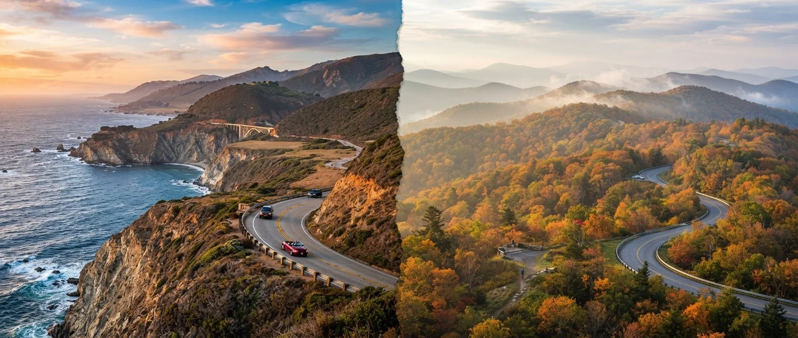
Photo: TrendingResults.net | Discover More, Trend More editorial
Key Takeaways
- PCH hugs the California coast for roughly 650 miles; the Blue Ridge Parkway spans 469 miles through Virginia and North Carolina.
- Both routes are free to drive, but lodging, fuel costs, and seasonal access vary significantly between them.
- PCH offers coastal towns and beaches; the Blue Ridge Parkway delivers mountain vistas and Appalachian heritage.
- The Blue Ridge Parkway closes sections in winter; PCH can face fog, mudslides, and closure after heavy storms.
- Both routes reward slow driving - plan at least five to seven days to do either justice.
The Routes at a Glance
The Pacific Coast Highway - often called PCH or Highway 1 - stretches roughly 650 miles along California's coastline, linking Los Angeles to San Francisco (and beyond). It's a state-designated scenic highway that weaves between steep cliffs, sea stacks, sandy coves, and surf towns. The drive can technically be completed in two days, but most travelers find five to seven days far more satisfying.
The Blue Ridge Parkway runs 469 miles from Shenandoah National Park in Virginia to Great Smoky Mountains National Park in North Carolina, managed entirely by the National Park Service. There are no stoplights, no commercial trucks, and a posted speed limit of 45 mph - a design intentionally meant to slow you down and soak in the Appalachian ridgeline. Plan on at least five days; a week lets you linger at overlooks and explore the surrounding towns.
| Criterion | Pacific Coast Highway | Blue Ridge Parkway |
|---|---|---|
| Total Length | ~650 miles | 469 miles |
| Primary Scenery | Ocean cliffs, beaches, coves | Mountain ridges, hardwood forest |
| Best Season | Spring & fall (fog in summer) | Late spring, summer, fall foliage |
| Winter Access | Possible closures after storms | Sections close due to ice/snow |
| Road Character | Winding coastal highway, varied traffic | 45 mph limit, no commercial vehicles |
| Nearby Cities | LA, San Francisco, Monterey | Asheville, Roanoke, Cherokee |
| Driving Cost | Higher fuel costs (CA gas prices) | Generally lower fuel costs |
| Road Trip Feel | Coastal energy, urban access | Quiet, immersive, nature-focused |
Both routes are free to drive - no toll booths required - though entrance fees apply if you detour into adjacent national parks. For a broader look at timing your trip, see our guide on peak vs. off-season travel.
Scenery and Terrain: Ocean Cliffs vs. Mountain Ridges
PCH's defining character is its coastal drama. The Big Sur stretch - roughly 90 miles of Highway 1 between Carmel and San Simeon - is often what people picture when they imagine the route: sheer bluffs, crashing surf, and the Bixby Creek Bridge hanging over a deep gorge. Fog is a regular companion, especially in summer mornings, which can soften views but also adds an ethereal atmosphere that many travelers love.
The Blue Ridge Parkway trades saltwater for high-elevation forest. At its highest point, the road crests above 6,000 feet near Richland Balsam in North Carolina. You're driving through dense hardwood and conifer forest, punctuated by wide-open overlooks dropping into valley farms and distant ridges. The Parkway connects to the Great Smoky Mountains at its southern terminus, adding a logical extension for many travelers.
Seasonality matters on both routes. PCH can close for weeks after significant storms or mudslides - particularly in the Big Sur area. The Blue Ridge Parkway closes certain sections in winter due to ice and snow, and conditions can shift fast at elevation. Always check the NPS website or Caltrans before you go.
Always Verify Current Road Conditions
Logistics, Costs, and Planning Considerations
Lodging along PCH ranges from roadside motels in small towns to upscale resorts in places like Carmel-by-the-Sea and Santa Barbara. Summer prices run high and rooms book quickly - especially on weekends near the Bay Area and Southern California. If you're flexible with dates, shoulder seasons (spring and fall) typically offer better availability.
Along the Blue Ridge Parkway, lodging options include NPS-run lodges (which book up months in advance for fall season), as well as cabins, B&Bs, and hotels in nearby towns like Asheville, NC, and Roanoke, VA. Asheville in particular has become a popular destination in its own right, with a well-developed food and arts scene. If you're curious about the broader regional road-trip context, our piece on road-tripping the American South covers the planning nuances worth knowing.
Fuel costs differ too. California's gas prices are consistently among the highest in the nation, which adds up over a multi-day coastal drive. The Blue Ridge Parkway corridor, by contrast, passes through areas of Virginia and North Carolina where fuel is generally cheaper. Either way, budget for more stops than you think you'll need - both roads reward the detour.
469 miles
Blue Ridge Parkway total length
The Blue Ridge Parkway is the most visited unit of the National Park System, drawing roughly 15-17 million visits in recent years according to NPS data.
45 mph
Maximum speed on Blue Ridge Parkway
The Parkway's intentionally low speed limit is part of its original 1930s design philosophy - built for scenic leisure, not transit.
~90 miles
Big Sur stretch of PCH
The Big Sur corridor is widely considered the scenic centerpiece of PCH and can require 3-4 hours to drive without stops, due to its winding cliffside nature.
The content on this site is provided for informational purposes only and should not be considered a substitute for professional advice. While we strive to provide accurate and up-to-date information, we make no guarantees regarding its completeness or accuracy. Always consult a qualified professional for advice specific to your circumstances before making any decisions.